Source2Sea in the Stour (UK) and Authie (France) catchments
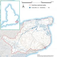
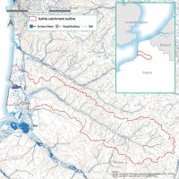
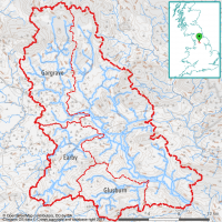
This Interreg project covered the Stour catchment in Kent and the Authie catchment in northern France, which together cover an area of approximately 2400km2. Viridian first sourced all the open-source data needed to run HydroloGIS in both these territories, then modelled the most efficient and effective solutions to a variety of local problems. These included:
- Flooding of local towns and agriculture;
- Areas liable to accumulate water and cause pluvial flooding;
- Diffuse nitrate and phosphate pollution in the rivers;
- Soil being washed into the rivers to cause siltation; and
- Drought and reduced baseflow to the rivers during periods of low rain
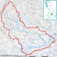
- Stour Management catchment
The Kent Stour management catchment covers approximately 1100 km2 on the eastern coastal side of Kent. The Stour catchment is low elevation (below 200m) and primarily consists of pasture and grassland, with areas of coastal and inland marsh. The Great Stour and Little Stour form the main rivers in this catchment, flowing from west to east; with other rivers flowing directly to the sea.
The Authie catchment covers approximately 1200 km2 on the northern coast of France. The Authie catchment is low elevation (below 200m) and primarily consists of pasture and arable land, with areas of woodland and some few areas of marshland. In contrast to the Kent Stour catchment, there are no significant settlements within the Authie catchment, with smaller settlement areas being distributed throughout the catchment. The Authie is the main river in this catchment flowing from east to northwest.
- Authie catchment
The client wished all these problems to be solved through natural catchment management, so that they would benefit wildlife and be robust to climate change. Viridian therefore modelling the most effective interventions from the following options:
- Woodland planting;
- Creation of meadows (semi-natural grassland);
- Planting of hedgerows;
- Increasing soil infiltration;
- Construction of reservoirs or ponds;
- Construction of leaky dams or woody debris dams;
- Construction of mid-field swales and bunds;
- Creating or re-instating wetlands; and
- Reconnecting flood plains
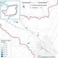
- Natural depressions for reservoir potential
This map shows where natural depressions in the Stour landscape have been determined through digital elevation model analysis. These provide a set of opportunities for locating reservoirs or improving groundwater infiltration.
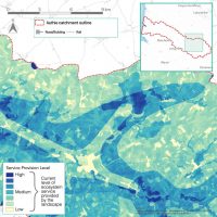
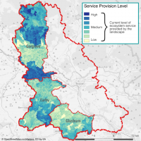
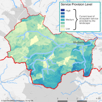
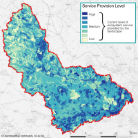
This map shows the current relative ability of a portion of the Authie catchment to deliver a combination of ecosystem service benefits (erosion control, diffuse pollution reduction and flood mitigation). The hydrologic treatment of the landscape is convolved with factors such as vegetative cover, peak monthly rainfall, soil, etc, to establish how water flows across the landscape. Where Viridian scores the landscape poorly indicates where habitat planting will have a greater impact in mitigating flow, and hence flooding. One can see individual fields in this map due to the availability of open spatial crops data, allowing HydroloGIS to make finer tuned prioritisations across the landscape.
- Service provision in Authie
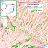
- Woodland priority planting against flow paths
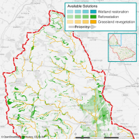
Since Viridian’s HydroloGIS tool is equipped to exclude solutions, we provided a set of data layers that showed where woodland/hedgerow features would be best situated to intercept landscape flows to reduce downstream flooding. In this map, the deeper green features are higher priority planting areas. One can see from the overlaid flow paths that woodland features are optimised to intercept more significant flow paths to reduce the overall flooding to the conurbations around Dover.
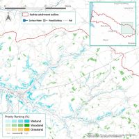
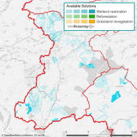
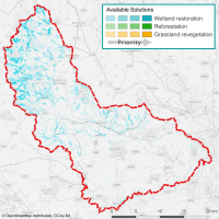
In addition to determining the relative ability of the landscape to deliver ecosystem services, HydroloGIS determines where planting new habitat will maximally increase those ecosystem services using a ranked system (here, deeper colours represent higher ranks). In doing so, the decision work of determining what to do where is given an intuitive priority ordering, enabling people to know where habitat planting will best reduce the impacts of flooding, soil loss, diffuse pollution, and combinations thereof.
- Optimised solutions for a basket of ecosystem services
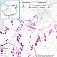
- Infiltration opportunites
Using the principle that holding water on the surface in areas of deep, well functioning soils will encourage a high degree of percolation, the HydroloGIS flood prioritisation scores were filtered to only include those areas above permeable geology. Slowing overland flows through nature based solutions in these areas, thus offers a guide to where opportunities to improve soil infiltration are best investigated for additional ecosystem service benefit.
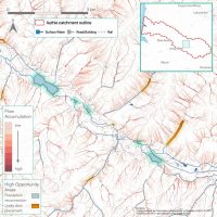
Using our regular eyes, as well as our AI’s, Viridian gets a little more insight into the situation on the ground, and thus reveals opportunities that are sensible ideas for natural flood management which may not be within the remit of optimised habitat planting. In this map, we illustrate where there are opportunities for floodplain reconnection and leaky dams along the riparian system
- Floodplain reconnection and leaky dam opportunities
